Images of lands traversed and things encountered have long been important findings of explorations. The Lewis and Clark Expedition gathered mineral, plant, and animal specimens and – just as important – the leaders’ journals contained detail-rich drawings of birds, fish, plants, and geologic features.
What Lewis and Clark could not provide were photographs – since that technology did not exist in 1805. It was not until two decades later that Nicephore Niépce captured an eight-hour exposure using a copper plate covered in bitumen. Taken in France, “View from the Window at Le Gras” is reportedly the world’s first photo.
Collaborating with Niépce, Louis Daguerre experimented with silver iodide and salt, and created in 1839 the first Daguerreotype image. This process lowered exposure time to minutes and even seconds in bright conditions. While still a cumbersome endeavor, Daguerreotype photography had a wider range of uses than the Niépce approach.
The first western U.S. expedition to take advantage of Daguerreotypes was John C. Frémont’s 1853 survey from Missouri to Utah. It was in search of a viable route for the transcontinental railroad. Solomon Carvalho was the company’s Daguerreotypist. Carvalho was also an accomplished painter.
While he took images throughout the trek, harsh winter weather forced Carvalho to abandon gear and numerous image plates in the high mountains. Surviving massive snows and near starvation, the party sought shelter in Parowan, UT. To recover his health, he traveled to Salt Lake City, and there, Carvalho – raised in the Jewish faith – became fast friends with Brigham Young. He painted portraits of Young and Native American chief Wakara that are well-known to this day. Unfortunately, few daguerreotype images remain from this expedition.
By 1848, collodion wet plate technology using albumen paper offered fast exposure times and enhanced reproducibility compared to daguerreotypes. Matthew Brady and others put this process to the test during the Civil War. The technique used portable dark rooms in the field (picture the big box on a tripod with the dark curtain covering the photographer). Prep work was complex, and image development could take five to 20 minutes. However if the photographer was not satisfied with the image, the glass plate could be reused, making for a significant advance in utility. Photographers who were expert in this process joined all four of the “Great Surveys” that began to explore the West after the war:
- Timothy O’Sullivan (an acolyte of Brady) and C.E. Watkins (an early documenter of Yosemite) accompanied Clarence King’s 1867 survey of the Fortieth Parallel.
- William Henry Jackson produced dramatic images of Yellowstone and surrounding country in the 1869 survey led by F.V. Hayden.
- J. K. Hillers, James Fennemore, and E. O. Beaman documented John Wesley Powell’s second voyage down the Grand Canyon in 1871. No known photos exist of Powell’s 1869 exploration.
- O’Sullivan subsequently documented G.M. Wheeler’s 1872 survey of the One Hundredth Meridian. On this survey, O’Sullivan took numerous images of Native American life in the Southwest.

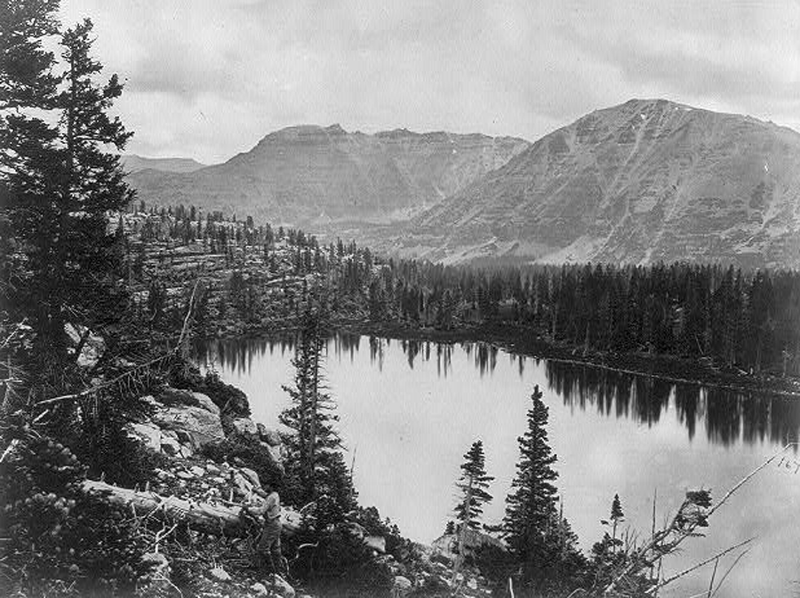
Credit: Photo courtesy of the Utah Division of State History
An early audience for the images was the U.S. Congress. For example, King had O’Sullivan’s work exhibited in the U.S. Capitol to bolster his request for extended survey funding. This “exposure” to the powers that be in Washington may have contributed to Congress appointing King as the first director of the U.S. Geological Survey in 1879.
At a high level, the collective efforts of these and other western photographers fired the imagination of the country. The images were instrumental in spurring expansion into the Western U.S. and driving land policy, such as the creation of national parks.
O’Sullivan had perhaps the most direct ties to Summit County of all the photographers mentioned. As a member of the King survey, which actually started in California and worked its way east, O’Sullivan took numerous photos of the Wasatch and Uinta ranges, including some beautiful images of Christmas Meadows. Along the way, he spent time on the Weber River near Henefer and Echo and captured striking images of Devil’s Slide and the Witches Rocks.
The Park City Museum is hosting a free in-person lecture on Wednesday, September 7 from 5 to 6 p.m. at their Education and Collections Center at 2079 Sidewinder Drive. Lecturer Dorian De Maio will discuss fur trappers who made pathways and routes across the West after Lewis and Clark’s explorations. Register at parkcityhistory.org.