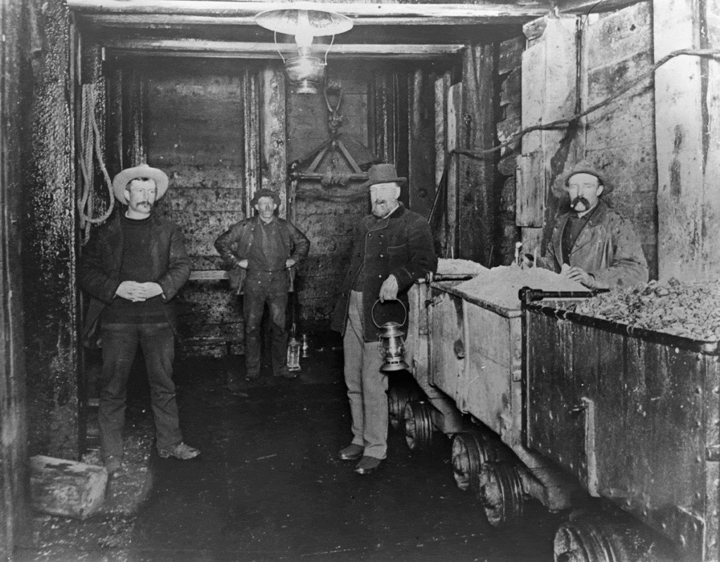
Today if someone was to ask you, “Is that guy on the level?” you might answer “Yeah, you can trust him.” But in the 1890s in Park City, your answer might be, “Yep, he’s on the 1,200-foot level of the Ontario No.2 shaft“. To understand this, you need to know something about underground mining.
The orebodies in the Park City mining district occurred over a wide range of depths and were primarily developed from vertical shafts. Tunnels would be developed horizontally from the shafts at multiple depths. Each of these tunnels were called “levels” and named for their depth measured down the shaft from the ground level.
In the Ontario Mine the main orebody was a steep vein, or “lode,” deposit that extended from the ground surface to over 2,000 feet deep. The Ontario Mine developed levels down the No. 2 and No. 3 shafts to exploit this orebody. By 1902 the Ontario No. 2 shaft had levels every 100 feet down to the bottom of the shaft at 1,500 feet. The No.3 shaft had the same levels but down to its total depth of 2,000 feet! These levels were driven from the shafts to the lode. Once miners intercepted the lode, they turned production tunnels, or “drifts,” along the lode; completed timbering to support the drifts; and mined the ore above the drifts in an “overhand” manner.
As they mined upward, they created an open space where they had removed the ore, called a “stope.” To stabilize the open stopes from collapse, they used a three-dimensional grid of interlocking timbers called “square sets.” As they mined upward in the stopes the square sets were carried up to within working distance from the roof of the stopes where the miners were actively removing the ore. The open square sets were then backfilled with waste rock from other parts of the mine. This further stabilized the stopes from collapse and offered a convenient way to get rid of much the waste rock, instead of having to haul it out of the mine.

Credit: Park City Historical Society & Museum, United Park City Mines Collection
Another driver of level development in the mines was the need to drain groundwater out of the workings in the most economical manner. Typically, removing water up the mine shafts required expensive pumping equipment, plus labor and fuel costs to operate the steam-powered pumps, but by 1881 the Ontario Mine drove a drainage tunnel (the Ontario No.1 along Marsac Avenue) from lower Ontario Canyon over 6,300 feet south into the mountain to intercept the Ontario No.3 shaft at its 600-foot level. Groundwater down to this level could then flow by gravity out of the tunnel. The deeper levels in the Ontario mine were dewatered by pumping water up the No. 3 shaft to the 600 level and out the tunnel.
The same Ontario drainage tunnel was eventually connected with the nearby Daly and Daly-West mines. But the drainage tunnel at the 600-foot level of the Ontario mine was not called that in those other mines because the ground surface elevation of the shafts at the Daly and Daly-West mines were progressively higher than at the Ontario mine. The drainage tunnel at the Ontario’s 600-foot level connected with the Daly mine at its 800-foot level and the Daly-West mine at its 1,200-foot level.
An even deeper drainage tunnel connected to these mines was constructed later from a portal at Keetley, which is now on the west shore of Jordanelle Reservoir. This tunnel was initially driven over 15,000 feet to connect with the Ontario mine at its 1,500-foot level!
So, if you look at a map of the underground workings in the Park City mining district you will see a bewildering spider web of tunnels and drifts, many of which cross the historic mine property boundaries to connect the underground workings. You will also notice that the same tunnel or drift is labeled as a different “level” when you cross the property boundaries. This is no mistake, and these labels are “on the level” as we might say.
Learn more about mining in Park City through lectures on the Park City Museum YouTube Channel.