This is the fifth article in a series on the Conkling Mining Co. v. Silver King Coalition Mines Co. lawsuit.
As we learned last time, Trewek believed a patent on the Conkling claim was thought a full claim of 1,500 feet in length. Regarding said claim patent, a revision of the 1872 Mining Law provided a process by which claims could be patented (owned outright). Anyone who had properly located a claim could file a patent application. The application was to be accompanied by a plat map and field notes made or authorized by the surveyor general, and two affidavits verifying that the claim had been distinctly marked at the site and that notice of patent application had been posted.
Applicants were additionally required to do at least $500 worth of labor on the claim and prove that no adverse claims had been filed. After these requirements had been met the applicant could purchase the mineral land for $5 an acre. A mineral certificate issued by the district land office entitled the claimant to a federal patent.
A patent was granted by the United States government to the Boss Mining Company, predecessor to the Conkling Mining company, for the Conkling lode mining claim on February 23, 1892. The patent gave the Boss exclusive title to the locatable minerals, all resources, and more than 20 acres of land. When the patent was issued by the land office to the Boss Mining company, it called for a claim 1,500 feet long by 600 feet wide, the regulation mining claim.

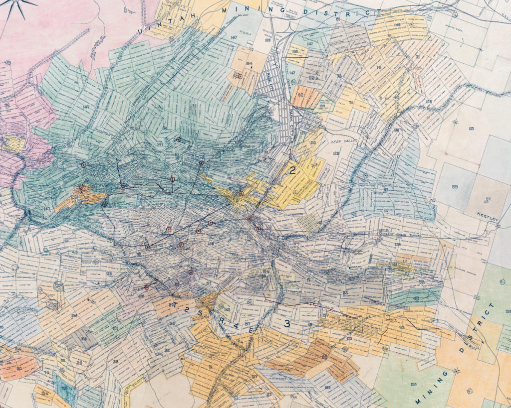
Credit: Park City Historical Society & Museum, Jack Gallivan Collection
In November of 1889, Adolph Jessen, deputy United States mineral surveyor, made a survey of the Conkling lode mining claim in Park City. His legal description of the site read as follows:
Beginning at corner No. 1, a pine post four inches square marked U. S. 689 P. 1. Thence by courses and distances northwesterly to corner No. 2, a pine post four inches square marked U. S. 689 p. 2. Thence second course, south sixty degrees and forty-five minutes west one thousand five hundred feet to corner No. 3. Thence third course, south twenty-one degrees and nine minutes east six hundred feet to corner No. 4.
A claim was to be “distinctly marked on the ground so that its boundaries could be readily traced.” Distance was measured by a chain or tape or triangulation. Angles were determined by a theodolite. A solar compass was used to indicate direction and establish bearing. The solar compass operated somewhat like a sundial. There were often inaccuracies due to the equipment used and terrain.
Rising nearly 600 feet in elevation in its 1,500-foot length, the Conkling lode mining claim was situated in steep, rugged country at an altitude of nearly 8,000 feet. Descending south into Walker and Webster Gulch, the surface was covered in part with large trees and thickets of brush and undergrowth. The snowfall that November of 1889 was very great. In other words, it was not difficult to have mis-measured the official survey.
Fast forward to the pending lawsuit in 1908, the Silver King Coalition Mines company, through its general manager Thomas Kearns, asserted that the Conkling company patent was defective. The surveyors’ field notes introduced by the Silver King Coalition revealed that the claim was not 1,500 feet long, but 1,364.5 feet, meaning Trewek might not have a case against the Coalition.
This story will be continued (next we learn about the man who performed the 1889 survey). The Park City Museum and Friends of Ski Mountain Mining History are hosting a virtual lecture next Wednesday, May 5 from 5 p.m. to 6.p.m on the hist or the Daly West shaft and headframe. Register here.